
Table of Contents
What is Land Conversion?
Legal Basis for Land Conversion
Types of Land Use
Who Needs Land Conversion?
Procedure: Steps & Documents Required
Government Authorities Involved
Timeframe & Costs
Legal Risks If Not Converted
Understanding Encumbrance Certificate (EC)
What Is an EC?
Why It’s Important
How to Obtain an EC in West Bengal
Application Process
Documents Needed
Online vs Offline Route
Timeline & Fees
Survey Maps / Land Surveys in West Bengal
What Are Survey Maps?
Types of Surveys / Map Classifications
Role in Land Transactions & Dispute Resolutions
How to Get a Survey Map Updated
Who Maintains Survey Maps / Records
Relationship Between the Three
How Land Conversion Relates to EC & Survey Maps
Use Case: Buying a Property – Checklist
Common Problems & Disputes
Illegal Constructions / Misuse of Land
Conflicting Survey Maps & Old Records
EC Showing Undisclosed Encumbrances
Rejection of Conversion Application
Tips & Best Practices
Before Purchasing Land
Maintaining Land Documents If You Own Land
Dealing with Authorities & Getting Legal Help
Conclusion
What is Land Conversion?
Legal Basis for Land Conversion
Land conversion refers to the official changing of the permitted land use category by the government or local authority. In West Bengal, land is typically classified by use: agricultural, residential, commercial, industrial, etc. Legal statutes—both state and local (municipal or panchayat level)—govern what uses are permitted and which require formal permission to deviate or change. Change without permission is illegal and can lead to penalties.
Types of Land Use
Agricultural Land: Land meant primarily for farming or related activities.
Residential Land: Areas zoned or permitted for housing.
Commercial / Industrial Land: For business, factories, shops, offices.
Mixed Use / Zone-specified: Some plots are allowed mixed purposes depending on zoning.
Who Needs Land Conversion?
Individuals who own agricultural land and wish to build houses or sell for residential purpose.
Developers buying rural land to convert into housing or commercial plots.
Owners who want to change current use (for example, from residential to commercial).
Procedure: Steps & Documents Required
Check Zoning & Local Land Use Plan
Verify whether your land falls in a zone where conversion is possible. Municipalities & Panchayat offices will have development plans / zoning maps.
Application to Appropriate Authority
For urban areas, usually the municipal corporation or development authority (e.g., Kolkata Municipal Corporation, Bidhannagar).
For rural or semi-urban areas, may need to apply to the Panchayat or District Land & Land Reforms Office.
Submission of Documents
Proof of ownership (sale deed, title deeds)
Maps / survey plan of plot (often certified map)
Existing land use certificate (for agricultural classification)
Land tax receipts, mutation records
No Objection Certificates (NOC) from relevant authorities (e.g., fire, environment, water) if needed
Inspection & Report
Local authority may send surveyors to inspect land, check dimensions, boundaries, usage, public amenities
Approval & Change of Record
Once accepted, the land records (mutation register, etc.) are updated to reflect the new permitted use
Payment of Conversion/Development Charges
The authority may impose fees / charges for conversion.
Government Authorities Involved
Land & Land Reforms Department, West Bengal
Panchayat & Rural Development Department
Municipal Corporation or Municipality / Development Authority
Town & Country Planning Department
Zilla Parishad, if in rural jurisdictions
Timeframe & Costs
Time depends on locality, whether records are clean, whether there are objections. It can range from a few weeks (municipal) to several months (rural / disputed areas).
Costs vary: application fees, conversion charges (sometimes steep for commercial conversion), survey fees, taxes.
Legal Risks If Not Converted
Penalties, fines
Demolition of unauthorized constructions
Inability to get key permissions (water, electricity connection)
Problems selling the property legally
Understanding Encumbrance Certificate (EC)
What Is an EC?
An Encumbrance Certificate is an official document issued by the sub-registrar’s office listing all registered transactions (deeds/mortgages/leases) related to a property over a specified period. It shows whether there are any legal liabilities, charges or mortgages on the property.
Why It’s Important
Assures the buyer that the seller has clear title (no mortgages or liens)
Used for bank loans / mortgages to assess risk
Prevents future legal disputes
How to Obtain an EC in West Bengal
Application Process
Identify the correct sub-registrar office where property deeds are registered
Fill out prescribed form requesting EC for certain years (e.g., past 13 years)
Documents Needed
Copy of deed / title deed or measurement details of the property (plot number, ward, etc.)
Applicant’s identity proof
Details of owner or previous owner
Online vs Offline Route
Some sub-registrar offices / state government portals allow online application & payment
Offline: submitting paper form, visiting registrar’s office
Timeline & Fees
Time varies with number of years requested and backlog; often 1‑2 weeks if records are well‑maintained
Fee depends on the period of EC, local office fee schedule
Survey Maps / Land Surveys in West Bengal
What Are Survey Maps?
Survey maps / land surveys are technical drawings that depict the boundaries, dimensions, shape, and location of a plot of land. They often include adjoining roads, landmarks, plot numbers. They may be topographical or cadastral in nature.
Types of Surveys / Map Classifications
Cadastral Survey: Official record showing plot boundaries and owners, used for land revenue and registration.
Topographical Survey: Includes elevations, contours, natural features – forests, water bodies.
Subdivision or Layout Survey: When land is subdivided into smaller plots or layouts, especially in urban development projects.
Role in Land Transactions & Dispute Resolutions
Confirms exact boundaries to avoid encroachment disputes
Ensures what you are buying matches what is registered in records
Courts often rely on survey maps during boundary disputes
How to Get a Survey Map Updated
If maps are outdated (old records, mismatches), initiate a survey through the Survey & Land Records Department
May require hiring a licensed surveyor, submitting existing map, deed, property plan
After survey, submit to local land registry or municipality to get maps updated
Who Maintains Survey Maps / Records
Survey & Settlement Department, West Bengal
Land & Land Reforms Department
Local municipal or panchayat offices (especially for urban plots / layouts)
Sub-registrar offices for registration records
Relationship Between the Three
How Land Conversion Relates to EC & Survey Maps
Survey maps provide proof of boundaries and dimensions, which are essential when applying for conversion.
EC confirms that there are no legal encumbrances that would prevent conversion—for example, if the property is mortgaged, or subject to court orders, conversion authorities may refuse until matters are cleared.
Conversion once granted updates official records; survey maps and registration records must be consistent.
Use Case: Buying a Property – Checklist
Obtain survey map and cross‑verify with field measurements.
Get EC for past 10‑20 years to ensure no undisclosed encumbrances.
Check whether property is already converted to desired use (residential/commercial). If not, estimate costs & time for conversion.
Inspect local zoning, development plan for the area to understand permissible usage.
Ensure seller has all land‐reform or mutation records, tax receipts, no pending litigation.
Common Problems & Disputes
Illegal Constructions / Misuse of Land
Building without prior conversion or violating zoning laws often leads to demolition orders or legal notices from local municipal or planning authorities.
Conflicting Survey Maps & Old Records
Sometimes boundary descriptions in old deeds differ from recent maps; adjoining landowners may have encroached; public paths or roads may have changed. These conflicts can delay registration, conversion, or lead to court cases.
EC Showing Undisclosed Encumbrances
Buyers are often surprised by mortgages, lien, or litigation that wasn’t disclosed. Since EC only shows registered transactions, unregistered encumbrances (like oral agreements) can be tricky.
Rejection of Conversion Application
Common reasons: zoning restrictions, objections from neighbors, incomplete documents, non‑payment of taxes, violation of environmental norms, or non‑compliance with local planning regulations.
Tips & Best Practices
Before Purchasing Land
Do field verification: check boundary markers, actual physical terrain.
Collect all title documents back several generations.
Always obtain EC for sufficient period.
Review survey maps.
Consult local authorities about zoning & permissible use.
Maintaining Land Documents If You Own Land
Keep deeds, mutations, maps and tax receipts updated.
Ensure land records show your name in mutation register.
Update survey maps if any boundary changes or developments.
Pay land revenue and property tax punctually.
Dealing with Authorities & Getting Legal Help
For complicated cases (historical dispute, missing titles) hire a lawyer experienced in land law.
For conversion, interact with local municipality or development authority early; clarify requirements.
If records are old or missing, check with revenue office or archival offices.
Use certified/licensed surveyors for mapping.
Conclusion
Land matters in West Bengal are governed by complex legal, regulatory, and administrative processes. Whether it’s converting land usage from one category to another, securing an encumbrance certificate to establish a clean title, or verifying the mapping and boundaries of your property, each step is critical for safe and lawful ownership or transaction. By following the right procedures, collecting proper documentation, using accurate survey maps, and staying compliant with zoning and land laws, you can minimize risk and protect your property rights.
Nature’s Paradise by Rupbasuda Developers — “Ready to Move” Plots


After covering what to check, here is detailed, well‑organized information about Nature’s Paradise, a township project by Rupbasuda Developers, to help you evaluate whether it meets those criteria and whether it might be a good option for you or others.
Project Overview
| Feature | Details |
| Project Name | Nature’s Paradise |
| Developer | Rupbasuda Developers |
| Location | Khariberia, Bhasa, Joka, Kolkata |
| Highway / Road | Along Diamond Harbour Road, National Highway 117 |
| Distance from Joka Metro | Approx 2.6 km |
| Time from Swaminarayan Temple | About 7 minutes |
| Nearby Landmark | Beside Palm Village Resort |
Plot Size, Type & Pricing
| Parameter | Details |
| Spread of Project | ~ 350 bighas of land area |
| Minimum Plot Size | 2 katha minimum purchase |
| Other Sizes Available | 3 katha, 5 katha, and more; no fixed maximum limit specified |
| Types of Plots | Premium & non‑premium; Residential & Commercial |
| Price Range | ₹1,30,000 (1 lakh 30 thousand rupees) up to ₹4,00,000 (4 lakh rupees) depending on plot size, location, type etc. |
Amenities & Infrastructure
| Amenity / Infrastructure | Present or Planned |
| Plot Status | Ready to move plots – so basic land preparation is done |
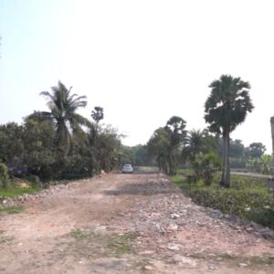
| Roads | Internal by‑roads of 25 ft & 20 ft; the approach roads being/will be four‑lane |
| Water supply | 24×7 water supply planned / provided |
| Electricity | Electricity connection available / planned |
| Drainage / Sewage | Proper drainage system in place or planned |
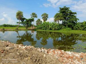
| Community & Recreational Facilities | Gymnasium, Clubhouse, Lake, Kindergarten School, Saraswati Temple |
| Transport | 24×7 transportation; metro station planned by end of 2028; nearby railway station etc. |
| Nearby Essential Facilities | Hospitals, Vegetable Market, Shopping Malls, Schools, Colleges just minutes away |
Location Advantages & Growth Potential
- Close proximity (2.6 km) to Joka Metro adds value and future ease of commute.
- Diamond Harbour Road (NH‑117) is a major route; improved highways/roads often lead to value appreciation.
- Many well‑known apartment projects in the vicinity (Emami Astha, Godrej Seven Elevate, Gems Bouganvilla, DTC Sojan, Eden Amantran, Solaris, Rajat by Avante etc.), often priced in crores, which suggests the area is already drawing premium development.
Payment & Booking Terms
| Parameter | Details |
| Booking Token Amount | ₹11,000 required as token booking amount |
| Payment Options | 36 months 0% interest EMI available |
| Developer / Agent | Dedicated Real Estate, with office near Thakurpukur 3A Bus Stand, Kolkata |
Potential Pros & Things to Check
Pros:
- Affordable entry point for middle class — both residential and commercial plots in the stated price range.
- Ready to move status reduces waiting time; some infrastructure already in place.
- Strong potential for appreciation because of upcoming metro, highway road works, location.
- Amenities are planned; community features suggest a self‑contained township rather than isolated plots.
Things you should still verify (using the checklist above):
- Confirm zoning status and whether NA conversion (if needed) has been done.
- Check encumbrance certificate to ensure clear title.
- Ensure all NOCs, permissions, layout plan approvals are legal and in order.
- Physical ground check: slope, drainage, whether land is flood‑prone.
- Exact road access: condition of roads, whether approach to your plot is via public road.
- Surrounding environment: whether neighbouring plots are being developed, quality, types of constructions.
- Utility access and readiness: water, electricity, sewage.
- Confirm any government notifications/plans that may require surrendering land or affect use.
Why This Might Be The Best Time to Buy
- With metro station planned by end of 2028, road improvements, and area being developed, plots may gain significant capital appreciation.
- Since many high‑end projects in the area are already valued in crores, a plot bought now at a few lakh rupees can deliver large value growth in coming years.
- Entry‑level price and flexible payment (0% EMI over 36 months) reduces the financial burden and risk.
How to Proceed (if Interested)
- Arrange a site visit to Nature’s Paradise. Survey multiple plots; compare premium vs non‑premium.
- Bring along a legal expert to verify documents.
- Ask developer / Dedicated Real Estate for copies of title deed, NA conversion (if applicable), EC, layout plan, approved plan, NOCs etc.
- Check the condition of internal roads, availability of utilities.
- Discuss payment schedule, any additional charges.
Contact Details
Dedicated Real Estate
- Phone: +91 6291422636
- Email: info@dedicatedrealestate.in
- Website: www.dedicatedrealestate.in
Office Location: Near Thakurpukur 3A Bus Stand, Kolkata


