
Buying land is a big investment. In areas like Newtown / Raspunja (near Rajarhat / Greater Kolkata), the risk of flooding, water logging, and wetlands encroachment is real. Urban sprawl, climate change, poor drainage, and historical wetland geography make some plots risky. This guide shows you how to assess these risks step by step so you can make an informed decision and avoid future losses.
Why Flood Risk, Wetlands & Water‑Logging Matter in Newtown / Raspunja
Geography & Wetlands: Newtown borders East Kolkata Wetlands (EKW), which are ecologically important RAMSAR wetlands and historically served as buffer zones, drainage basins, and fishery / agriculture areas.
Rapid Urbanization: Infrastructure development, filling up of canals/canals, conversion of wet lands to built-up area reduce natural water absorption.
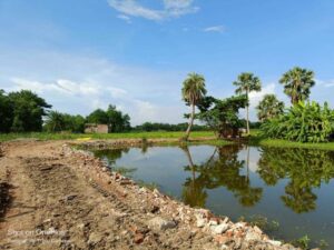
Existing Waterlogging Incidents: Newtown has experienced water logging during heavy rainfall in AB Block, BD Block, etc. Short periods of rain can submerge streets due to inadequate drainage.
Climate Change, Sea Level & Drainage Stress: With changing rainfall patterns, rising water table, sea level rise (for areas near rivers, wetlands), the drainage capacity is under pressure.
Understanding the risk is not optional: flooded land may lose value, houses may require extra foundation work or pumps; insurance may be hard to get; development may be restricted by local authorities.
Key Indicators to Check Before Buying
Here are the critical things to look for / questions to ask when evaluating a plot.
Wetland Status & Legal Zoning
Wetland Maps / RAMSAR boundary: Check whether the plot falls within or adjacent to East Kolkata Wetlands or other recorded wetland zones. Lands inside or close to wetlands may have restrictions on construction.
Zoning / Master Plan: Newtown is governed by NKDA (Newtown Kolkata Development Authority) / HIDCO / WB authorities. Check master plan, zoning regulations, land use classification. Is the land marked as wetland / buffer / reserved?
Elevation & Topography
Elevation above mean sea level (AMSL): Higher elevation plots are less prone to waterlogging and floods. Low‑lying plots will retain water. Use topographic maps, GIS tools.
Slope & grading: How the plot slopes relative to natural water flow and to existing drainage channels. Steep slopes may cause runoff; flat areas may lead to ponding.
Drainage Infrastructure & Stormwater Planning
Drainage channels / canals: Are there nearby canals / drains? Are they properly maintained? Are they functional or silted up? Do they have adequate cross-sections to handle heavy rains?
Stormwater management plans: Does the locality have stormwater drains, pumping stations, overflow paths? NKDA / local municipality plans for flood mitigation?
Historical Flooding & Waterlogging Incidents
Past complaints / news reports: Look up local newspapers, resident forums for episodes of waterlogging or flood in that block or street. For example, recent heavy downpours caused waterlogging in several streets in Newtown.
Satellite imagery: See images during monsoon season in recent years to spot inundation. GIS tools / Google Earth / Sentinel data (as used in studies).
Soil, Groundwater & Permeability
Soil type: Clayey soils hold water; sandy soils drain faster. Soil investigation via boreholes or site soil testing helps.
Groundwater level: High seasonal water table implies risk of seepage, dampness, needing special foundations or waterproofing.
Step‑By‑Step Guide: How to Do the Assessment in Newtown / Raspunja
Here is a practical workflow: from collecting data to confirming with authorities.
Step 1 – Gather Plot Information
Plot number, Sector / Block (Newtown “Action Area” number if applicable), survey number
Adjoining plots & location relative to canals / drains or wetlands
Seller’s disclosures: history of flooding, previous drainage or pump installations
Step 2 – Study Official Maps & Master Plans
Obtain master plan of Newtown from NKDA / HIDCO showing zoning, reserved wetland / buffer zones
Check Gazette notifications / legal notifications regarding wetlands and areas that are protected / restricted
Step 3 – Use GIS / Remote Sensing / Satellite Tools
Use Google Earth / GIS portals to look at elevation data, water bodies, visible wetlands, contours
Use published studies: e.g. Spatio‑Temporal Analysis of Canal Inundation, Elevation Changes… Action Area 1D, Newtown
Step 4 – Visit the Site During Rainy Season
Sight inspection when there is heavy rain: does water accumulate? How quickly does it drain? Where is water coming from / going to?
Check boundaries: Are there low‑lying areas bordering the plot that may drain into it?
Step 5 – Consult Local Authorities & Stakeholders
NKDA / HIDCO / Municipal / Wards offices: ask records of drainage, storm water infrastructure, flood-prone zones.
Local residents / neighborhood forums: they can inform recent flood events, whether pumps or temporary bypasses are used.
Step 6 – Soil Testing & Elevation Survey
Hire civil engineer or surveyor for level survey (benchmarks) and check elevation relative to nearby canals / drains
Soil test: percolation test, water table depth, ability of soil to drain
Step 7 – Check Regulatory Approvals & Insurance
Construction permissions: check if plot has conditional approval or whether development may be delayed due to waterlogging concerns
Is flood insurance / property insurance available for that area? If not, risk is higher
Specific Local Problems & Case Studies in Newtown / Raspunja
Action Area 1D Inundation & Canal Issues
Recent academic study in Action Area 1D shows canal inundation‑related water logging. Canals that were part of natural drainage are being encroached / their bed or capacity reduced.
Elevation profiles in that area have changed: some parts that were higher have been reduced due to filling or construction, making them more flood‑prone.
Wetland Encroachment & Loss
Transformation & risk assessment of East Kolkata Wetlands shows that human expansion, reclamation for aquaculture, agriculture, built‑up areas are eating into wetland areas.
Studies and maps show western / north‑western edges of EKW have become more vulnerable.
Examples of Waterlogging in Newtown
A heavy 45‑minute downpour caused waterlogging in Newtown in blocks like BD, AB, streets 165‑168 etc. Even “smart streets” got ankle‑deep water.
Drainage systems sometimes overwhelmed, or drains are not cleared, leading to storm water overflow.
Red Flags & Warning Signs
If you see any of the following, treat them as serious signals:
Plot within Wetland / Ramsar Buffer Zone
If official maps show the plot is part of or adjacent to wetlands, you may face legal/environmental restrictions, need special permits, limitations on building height or foundation type.
Low Elevation; Flat or Depressed Land
Plot is visibly lower than roads or surrounding plots; slope runs into it; water collects there. Drainage may be poor.
Poor / Blocked Drainage
Drains nearby are narrow, silted, non‑functional; canal beds have silt or encroachments; street drains overflow or back up.
Recent History of Flooding or Waterlogging
If local residents report flood every monsoon; news reports; repeated complaints. Also if you see mildew, water damage in neighbouring buildings, rusting etc.
Soil Does Not Drain
If you dig a test pit, water remains, soil is heavy clay and poorly pervious, water table is high. This may mean you need foundation / waterproofing or raising land level.
Mitigation Measures & What You Can Do to Reduce Risk
If you still like the plot or if risk is moderate, here are ways to mitigate:
Elevate Land / Raise Plot Level
Fill with good quality soil / gravel / compacted fill to raise plot above known flood/water‑logging levels. But check if fill is allowed per local regulations & whether it affects neighbouring drainage.
Ensure Proper Drainage Design
Design plot layout so water flows away; include stormwater drains; ensure connection to municipal drainage; ensure nearby canals / drains are functional.
Waterproofing, Foundation Protection
Use elevated stilts or raised plinth; use damp‑proof membranes; good foundation design to avoid seepage or flooding of basement or ground floor.
Legal Protections & Clauses
Include in sale agreement that seller must verify land is not in prohibited wetland or buffer zone; include warranties about no flooding incidents; include indemnity in case drainage failures.
Community / Infrastructure Engagement
Ensure local infrastructure (NKDA / local municipality) maintains canals, drains; you can participate in or lobby for clearing drains, desilting canals, enforcing wetland protection.
Tools, Data Sources & Agencies to Consult
Here are resources you can use to gather reliable data:
GIS / Remote Sensing Tools
Google Earth / Google Maps with historical imagery
Sentinel / Landsat / other satellite data for detecting wetlands, water bodies and inundation maps (used in academic studies)
Flood risk maps of Kolkata (public online maps)
Government Agencies & Authorities
NKDA (Newtown Kolkata Development Authority) / HIDCO for master plan, zoning, land‑use regulations
Kolkata Municipal Corporation or other local municipalities for drainage maps, storm water systems
State environment departments for wetlands regulation, environmental clearance, buffer zones
Scientific / Academic Studies
The paper “Spatio‑Temporal Analysis … Action Area 1D, Newtown” gives elevation changes, inundation data.
Studies on wetland transformation of East Kolkata Wetlands with geospatial and risk assessment methods.
Local Surveys & Experts
Civil / structural engineers or soil testing firms
Local surveyors for plot levels and drains
Legal experts familiar with wetland laws, environmental regulations
Cost / Time Estimates for Doing Due Diligence
Here are approximate efforts & costs involved in checking flood/wetland/waterlogging risk, so you can plan ahead.
| Task | Approx Time | Typical Cost / Considerations |
|---|---|---|
| Getting official maps / master plan from NKDA / authorities | Few days to 1 week | Copy fees; may require application or fees |
| Checking satellite imagery / GIS / remote sensing | Hours to 1‑2 days | Mostly free or low cost via public tools, or hire analyst |
| Soil test / ground water table / elevation survey | 1‑3 days | Surveyor fees; soil lab fees; transportation |
| Visiting during monsoon to observe waterlogging | 1 day | Travel; perhaps companion / appointment with locals |
| Checking legal / environmental clearances / wetland status | 1‑2 weeks | Legal fees; may need certified documents; application costs |
Sample Checklist Before Buying Land in Newtown / Raspunja
Here’s a checklist you can use in final decision / site visit to ensure you have covered all:
| Item | Yes / No / Needs Follow‑up | Notes |
|---|---|---|
| Plot shown on NKDA map; zoning legal | Is it designated residential / mixed use / wetland buffer etc | |
| Plot not inside RAMSAR wetland or reserved wetland zone | Are there official boundaries or notifications | |
| Elevation surveyed; plot higher than drain level / road / canal beds | Benchmark relative to surrounding features | |
| Drainage systems nearby: functional, connected, capacity adequate | Are drains cleared? Are canals free of encroachment? | |
| Waterlogging history reported locally (residents / news) | Which blocks? How often? Depth/duration | |
| Soil test / water table test shows good drainage or manageable mitigation cost | If soil retains water long, cost will rise | |
| Local authority approvals for building in area, permission to raise plot if needed | Any restricted height or fill regulations | |
| Insurance / flood protection available | For damage from heavy rains / flood / seepage | |
| Legal clause in sale deed re waterlogging/flood risk / wetland status | Seller’s disclosure; indemnity |
Benefits of Doing Your Homework & Consequences of Skipping It
Benefits
Lower risk of damage to property and money saved on remedial measures
Smooth approval of building permissions
Better resale value; safer for occupants
Reduced stress / risk in monsoon / unusual weather events
Consequences of Not Checking
Unexpected flooding costs: pumps, waterproofing, drainage work
Legal problems: violation if built in restricted wetland / buffer zone
Lower land value; difficult to sell
Health issues: dampness, mould, mosquito breeding etc
Conclusion
Buying land in Newtown / Raspunja has great potential—good infrastructure, connectivity, growing urban development. But wetlands, flood risk, waterlogging are not just theoretical—they are real, documented, and in many zones, already affecting daily life and development. If you do proper due diligence—checking zoning, elevation, drainage, history, soil, legal restrictions—you can avoid surprises, reduce risk, and make a sustainable investment.
Nature’s Paradise by Rupbasuda Developers — “Ready to Move” Plots


After covering what to check, here is detailed, well‑organized information about Nature’s Paradise, a township project by Rupbasuda Developers, to help you evaluate whether it meets those criteria and whether it might be a good option for you or others.
Project Overview
| Feature | Details |
| Project Name | Nature’s Paradise |
| Developer | Rupbasuda Developers |
| Location | Khariberia, Bhasa, Joka, Kolkata |
| Highway / Road | Along Diamond Harbour Road, National Highway 117 |
| Distance from Joka Metro | Approx 2.6 km |
| Time from Swaminarayan Temple | About 7 minutes |
| Nearby Landmark | Beside Palm Village Resort |
Plot Size, Type & Pricing
| Parameter | Details |
| Spread of Project | ~ 350 bighas of land area |
| Minimum Plot Size | 2 katha minimum purchase |
| Other Sizes Available | 3 katha, 5 katha, and more; no fixed maximum limit specified |
| Types of Plots | Premium & non‑premium; Residential & Commercial |
| Price Range | ₹1,30,000 (1 lakh 30 thousand rupees) up to ₹4,00,000 (4 lakh rupees) depending on plot size, location, type etc. |
Amenities & Infrastructure
| Amenity / Infrastructure | Present or Planned |
| Plot Status | Ready to move plots – so basic land preparation is done |
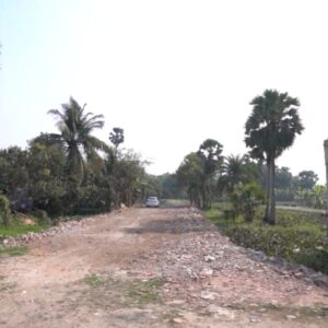
| Roads | Internal by‑roads of 25 ft & 20 ft; the approach roads being/will be four‑lane |
| Water supply | 24×7 water supply planned / provided |
| Electricity | Electricity connection available / planned |
| Drainage / Sewage | Proper drainage system in place or planned |
| Community & Recreational Facilities | Gymnasium, Clubhouse, Lake, Kindergarten School, Saraswati Temple |
| Transport | 24×7 transportation; metro station planned by end of 2028; nearby railway station etc. |
| Nearby Essential Facilities | Hospitals, Vegetable Market, Shopping Malls, Schools, Colleges just minutes away |
Location Advantages & Growth Potential
- Close proximity (2.6 km) to Joka Metro adds value and future ease of commute.
- Diamond Harbour Road (NH‑117) is a major route; improved highways/roads often lead to value appreciation.
- Many well‑known apartment projects in the vicinity (Emami Astha, Godrej Seven Elevate, Gems Bouganvilla, DTC Sojan, Eden Amantran, Solaris, Rajat by Avante etc.), often priced in crores, which suggests the area is already drawing premium development.
Payment & Booking Terms
| Parameter | Details |
| Booking Token Amount | ₹11,000 required as token booking amount |
| Payment Options | 36 months 0% interest EMI available |
| Developer / Agent | Dedicated Real Estate, with office near Thakurpukur 3A Bus Stand, Kolkata |
Potential Pros & Things to Check
Pros:
- Affordable entry point for middle class — both residential and commercial plots in the stated price range.
- Ready to move status reduces waiting time; some infrastructure already in place.
- Strong potential for appreciation because of upcoming metro, highway road works, location.
- Amenities are planned; community features suggest a self‑contained township rather than isolated plots.
Things you should still verify (using the checklist above):
- Confirm zoning status and whether NA conversion (if needed) has been done.
- Check encumbrance certificate to ensure clear title.
- Ensure all NOCs, permissions, layout plan approvals are legal and in order.
- Physical ground check: slope, drainage, whether land is flood‑prone.
- Exact road access: condition of roads, whether approach to your plot is via public road.
- Surrounding environment: whether neighbouring plots are being developed, quality, types of constructions.
- Utility access and readiness: water, electricity, sewage.
- Confirm any government notifications/plans that may require surrendering land or affect use.
Why This Might Be The Best Time to Buy
- With metro station planned by end of 2028, road improvements, and area being developed, plots may gain significant capital appreciation.
- Since many high‑end projects in the area are already valued in crores, a plot bought now at a few lakh rupees can deliver large value growth in coming years.
- Entry‑level price and flexible payment (0% EMI over 36 months) reduces the financial burden and risk.
How to Proceed (if Interested)
- Arrange a site visit to Nature’s Paradise. Survey multiple plots; compare premium vs non‑premium.
- Bring along a legal expert to verify documents.
- Ask developer / Dedicated Real Estate for copies of title deed, NA conversion (if applicable), EC, layout plan, approved plan, NOCs etc.
- Check the condition of internal roads, availability of utilities.
- Discuss payment schedule, any additional charges.
Contact Details
Dedicated Real Estate
- Phone: +91 6291422636
- Email: info@dedicatedrealestate.in
- Website: www.dedicatedrealestate.in
Office Location: Near Thakurpukur 3A Bus Stand, Kolkata


